뉴질랜드 > 북섬 여행
로토루아 산악자전거: 레드우드 숲 트레일 입문
로토루아 시내에서 차로 5~10분만 가면 거대한 캘리포니아 레드우드가 하늘을 가리는 숲이 나옵니다. 이 숲 바닥에는 화산 흙으로 다져진 산악자전거 길이 거미줄처럼 깔려 있고, 가족이 타는 평탄한 길부터 국제 대회가 열리는 점프 코스까지 한곳에 모여 있습니다. 이 글은 화카레와레와 숲(Whakarewarewa Forest), 흔히 '레드우드(The Redwoods)'라고 부르는 곳에서 산악자전거를 처음 타는 여행자를 위해 썼습니다. 누가 숲을 관리하는지, 난이도 등급 읽는 법, 입문자에게 맞는 코스, 그레이트 라이드인 Whakarewarewa Forest Loop, 출발 거점과 대여, 안전 수칙까지 정리했습니다. 정보는 2026년 9월 30일에 로토루아 레이크스 카운슬, 로토루아 관광청(rotoruanz.com), 레드우드 공식 사이트, 뉴질랜드 자전거 트레일 공식 사이트(nzcycletrail.com)에서 확인했습니다.
한눈에 보기
- 위치: 로토루아 시내에서 정문까지 차로 약 5분, 트레일 입구까지 약 10분
- 트레일 규모: 공식 자료마다 150km에서 300km 이상까지 다르게 적혀 있을 만큼 길이 많고, 계속 새로 생깁니다
- 입장료: 숲, 트랙, 방문자 센터 모두 무료입니다
- 개방 시간: 숲은 매일 오전 7시~오후 11시(크리스마스 제외). 안전을 위해 낮 시간 이용을 권합니다 (카운슬 레드우드 안내)
- 대표 코스: Whakarewarewa Forest Loop, 약 33km, 3~5시간, 대부분 2등급(쉬움)
- 계절: 연중 탈 수 있습니다. 화산 흙은 물이 잘 빠져 비가 온 뒤에도 금방 탈 수 있다고 안내됩니다
- 예약: 트레일은 예약이 필요 없습니다. 자전거 대여와 셔틀, 성수기(12~3월) 숙소는 미리 예약하는 편이 좋습니다
- 출발 전 확인: 로토루아 트레일 트러스트 트레일 폐쇄 공지
레드우드 숲은 누가 운영하나요
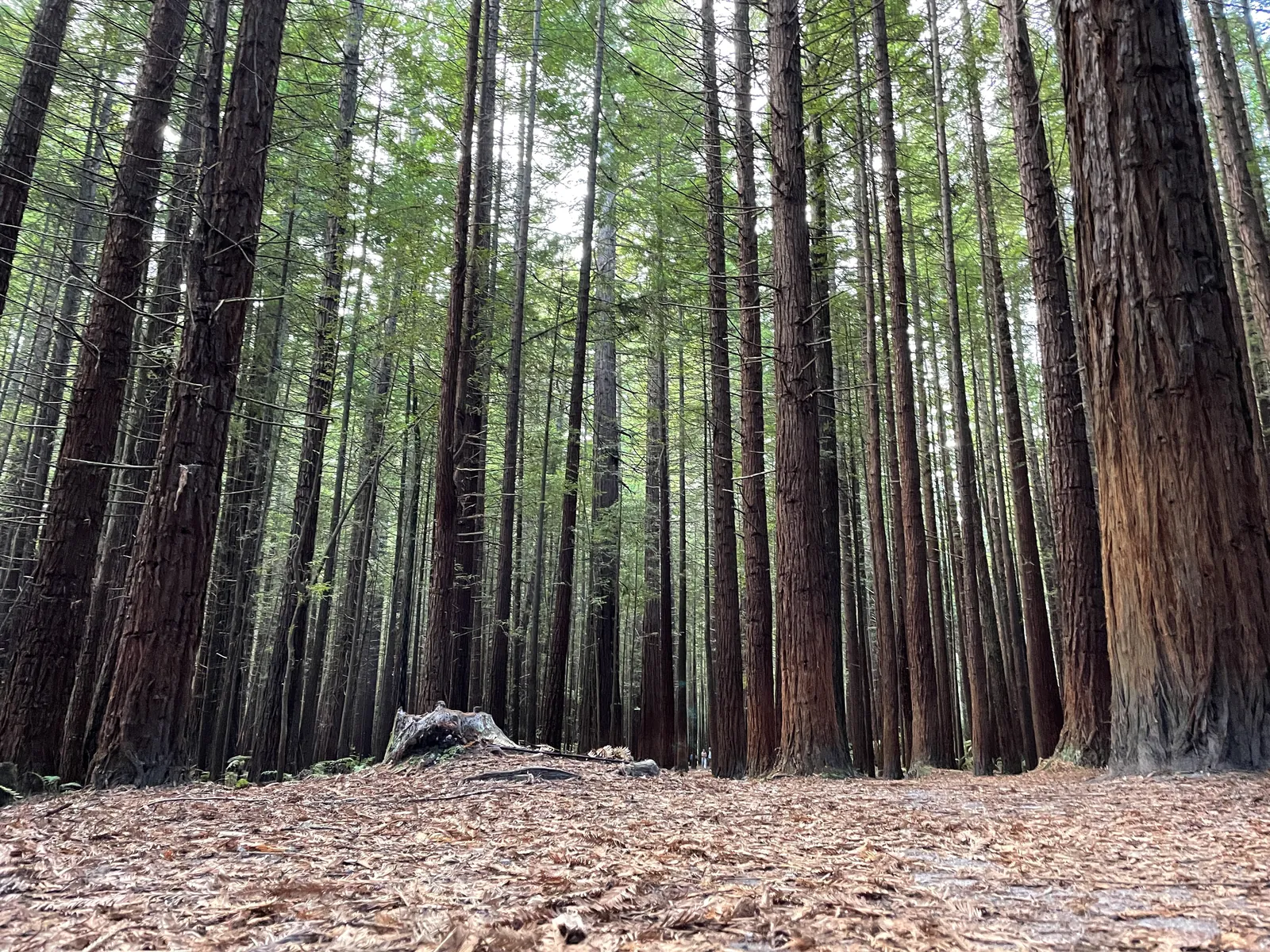
이 숲은 한 기관이 모두 관리하는 곳이 아니어서, 공지를 어디서 확인해야 하는지 알아 두면 좋습니다. 로토루아 레이크스 카운슬의 숲 프로젝트 페이지에 따르면 흔히 '레드우드'라 부르는 곳은 레드우드가 있는 토코랑이 숲(Tokorangi Forest)과 그 너머의 상업 조림지인 화카레와레와 숲을 합친 이름입니다.
- 땅 주인: 2008년 정부와의 합의에 따라 중앙 북섬 부족 연합 회사(CNI Iwi Holdings)가 땅을 소유합니다
- 레크리에이션 관리: 카운슬이 토코랑이 숲을 관리하고, 화카레와레와 숲의 레크리에이션도 조림 관리 회사(Timberlands) 등과 협약을 맺어 관리합니다
- 트레일 관리: 산악자전거 길은 자선단체인 로토루아 트레일 트러스트(Rotorua Trails Trust)가 만들고 고칩니다. 이용은 무료지만 기부로 유지되니, 즐겁게 탔다면 기부를 고려해 보세요
- 현지 부족: 투호우랑이 응아티 와히아오(Tūhourangi Ngāti Wāhiao)와 응아티 화케아우에(Ngāti Whakaue)에게 뜻깊은 땅입니다. 카운슬은 2043년 이용권이 끝나면 관리와 소유가 현지 부족에게 완전히 돌아간다고 밝히고 있습니다
이곳은 지금도 나무를 심고 베는 조림지입니다. 그래서 벌목이나 식재 작업이 있으면 트레일이 갑자기 닫히거나 우회로가 생깁니다. 출발 전에 트레일 트러스트의 폐쇄 공지와 현장 표지판을 확인하세요.
난이도 등급 읽는 법
레드우드 공식 사이트의 자전거 안내는 트레일을 여섯 단계로 나눕니다. 입구와 갈림길의 지도판에 등급이 표시되어 있고, 지도는 레드우드 안내 지도 페이지에서도 볼 수 있습니다.
- Beginner(입문): 거의 평탄하고 넓고 매끈한 길이나 자갈 도로
- Easy(쉬움): 대체로 평탄하고 완만한 오르막, 돌이나 파인 곳은 쉽게 피할 수 있습니다
- Intermediate(중급): 좁은 길에 가파른 경사와 장애물이 나올 수 있고, 미끄러운 곳이 있습니다
- Advanced(상급): 길고 가파른 오르막, 좁은 길, 피하기 어려운 장애물. 일부는 끌고 걷는 편이 낫습니다
- Expert(전문가): 기술이 필요한 구간, 급경사, 낭떠러지, 급한 커브, 자전거를 들고 가야 하는 곳
- Extreme(극한): 매우 가파르고 큰 낙차, 인공 구조물과 점프가 있습니다. 입문자가 갈 길은 아닙니다
전국 자전거 트레일 등급(1~5등급)으로 보면 Forest Loop는 대부분 2등급이고 짧은 3등급 구간이 섞여 있습니다. 산악자전거가 처음이라면 Beginner와 Easy 길에서 시작하고, 중급 길은 브레이크와 체중 이동에 익숙해진 뒤에 도전하세요.
Whakarewarewa Forest Loop: 입문자를 위한 그레이트 라이드
Whakarewarewa Forest Loop는 숲을 한 바퀴 도는 코스로, 2022년 5월 뉴질랜드 그레이트 라이드에 들어갔습니다. 관광청 Forest Loop 안내와 카운슬은 33km로 소개하고, Ngā Haerenga 공식 페이지와 레드우드 Forest Loop 페이지에는 35~36km로 적혀 있습니다. 대부분 시계 방향 일방통행입니다.
- 소요 시간: 3~5시간. 숙련자는 2시간 안팎이며, 전기 산악자전거는 조금 더 빠를 수 있습니다
- 노면: 넓고 고운 자갈과 화산 부석(경석) 길입니다. 산악자전거나 전기 산악자전거가 알맞습니다
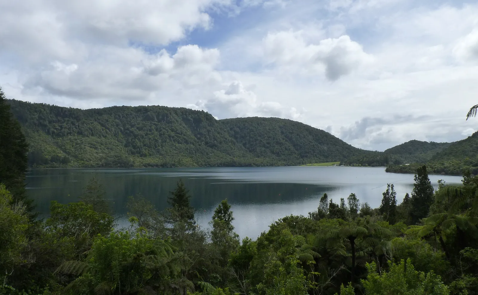
- 볼거리: 레드우드 숲, 로토루아 호수와 티키타푸 호수(Blue Lake) 전망, 김이 오르는 지열 지대와 끓는 진흙 웅덩이, 출발 거점의 투호우랑이 부족 조각 작품
- 편의 시설: 먹을 것을 파는 곳 3곳, 물 받는 곳 4곳, 장애인도 쓸 수 있는 화장실 3곳이 있습니다. 가게는 겨울이나 주중에 닫을 수 있어 간식을 챙기는 편이 안전합니다
- 충전: 코스 안에 전기자전거 충전소는 없습니다. 완전히 충전해서 출발하세요
- 주의: 가운데로 가로질러 돌아오는 길은 지름길이 아닙니다. 큰 언덕 조림지를 넘어야 합니다
- 문화 예절: 로토카카히 호수(Green Lake)는 문화적 이유로 사유 호수입니다. 표지판을 따르고 호숫가로 내려가지 마세요
Ngā Haerenga는 코스를 세 구간으로 나눠 안내합니다. 전 구간이 부담스럽다면 한 구간만 타도 됩니다.
- Te Pūtake o Tawa~Te Ara Ahi: 14km, 2~3등급(쉬움~중급), 1~2.5시간
- Te Ara Ahi: 8.5km, 2등급(쉬움), 30분. 시내 쪽으로 이어지는 평탄한 콘크리트 길입니다
- Waipa 주차장~Te Pūtake o Tawa: 10.5km, 2등급(쉬움), 1~2시간
같은 페이지는 입문자와 가족에게 맞는 짧은 코스도 소개합니다.
- Waipa–Dipper Loop: 5~6.5km, 2~3시간, 2등급. Waipa 주차장에서 출발하는 초보·아이용 고리입니다
- Titokorangi Loop: 8.5km, 2~3시간, 2~3등급. 레드우드 방문자 센터(Titokorangi Drive)에서 출발합니다
- Tikitapu Loop: 14.5km(짧게 8.5km), 1.5~2시간, 2등급. 티키타푸 호수에서 출발하며, 호수에는 수영할 곳과 바비큐 공간, 먹을거리 가게가 있습니다
출발 거점과 자전거 대여
- Waipa 주차장(Waipa State Mill Road): 산악자전거 이용자의 주 출입구입니다. 가장 쉬운 트레일과 Kids' Loop, Forest Loop가 바로 이어집니다. 대여점, 카페, 샤워, 자전거 세척장, 온수 풀이 있습니다
- Te Pūtake o Tawa(Tarawera Road): 2020년에 연 두 번째 거점으로 400대 이상 주차할 수 있습니다. 높은 쪽 트레일과 티키타푸 구간으로 바로 올라갈 수 있고, 먹거리와 대여, 세척·샤워 시설이 있습니다
- 레드우드 방문자 센터(Titokorangi Drive): 걷기 길의 출발점이자 지도와 정보를 얻는 곳이고, 위의 Titokorangi Loop가 여기서 시작합니다
- 셔틀: 숲 높은 지점까지 올라가는 셔틀이 있어 내리막 위주로 탈 수도 있습니다 (관광청 산악자전거 안내)
- 대여와 셔틀: 대여점과 셔틀 업체는 레드우드 자전거 대여·셔틀 페이지에 모여 있습니다
- 가이드와 강습: 처음이라면 가이드 투어나 기술 강습을 받는 방법도 있습니다. 숲 안에서 영업하도록 승인받은 업체는 레드우드 승인 업체 목록(Approved Concessionaires)에서 확인할 수 있습니다
일반 차량은 숲 안으로 들어갈 수 없으니 세 곳 중 한 곳에 차를 두고 출발합니다. 시내에서는 평탄한 자전거 길 Te Ara Ahi를 따라 자전거로 갈 수도 있습니다.
일정 예시
- 반나절(처음 타는 가족): Waipa 주차장에서 자전거를 빌려 Waipa–Dipper Loop처럼 입문·쉬움 등급 길을 탑니다. 끝나고 온수 풀에서 쉬어 가면 좋습니다
- 하루(자전거에 조금 익숙한 여행자): 아침에 Te Pūtake o Tawa에서 출발해 Forest Loop를 돌고, 점심 무렵 Waipa에 들러 식사한 뒤 나머지 구간을 마칩니다. 공식 안내도 이른 아침 출발이면 점심쯤 Waipa에 닿는다고 설명합니다
- 이틀(중급 이상): 첫날은 Forest Loop로 숲 지형을 익히고, 둘째 날은 셔틀을 타고 올라가 중급 내리막을 탑니다. 관광청은 Te Pūtake o Tawa 쪽 중급 내리막으로 Eagle vs Shark를 소개합니다
- 함께 묶기: 로토루아는 지열 온천 도시입니다. 라이딩 뒤 온천 일정을 넣으면 하루가 알찹니다
안전과 숲 이용 수칙
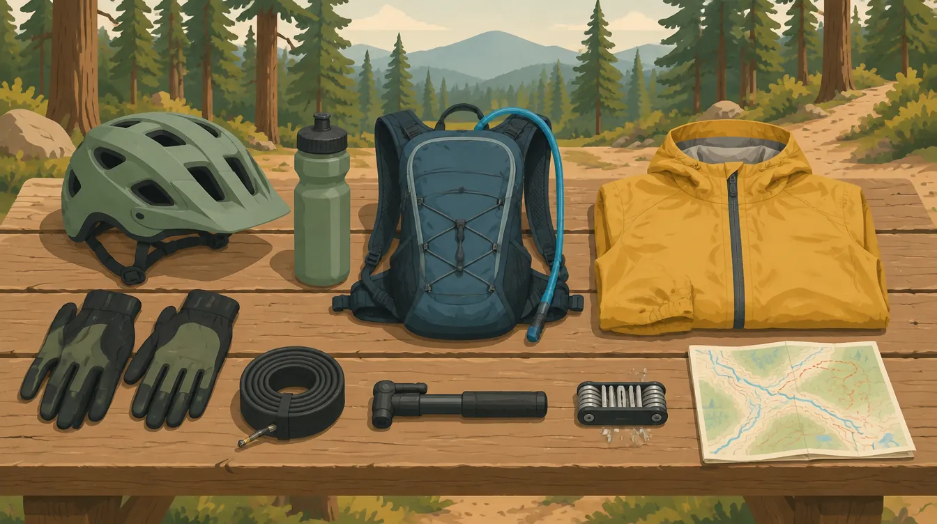
- 헬멧: 뉴질랜드는 자전거 헬멧 착용이 법으로 정해져 있습니다(NZTA 자전거 장비 규칙). 레드우드 수칙도 인증 헬멧과 보호 장비를 요구합니다
- 방향과 길: 트랙 화살표 방향으로 달리고, 지름길이나 새 길을 만들지 않습니다. 걷기 전용·자전거 전용·말 전용 길이 따로 있으니 자기 길을 지킵니다 (레드우드 이용 수칙)
- 양보: 임도는 임업 차량도 다닙니다. 보행자, 오르막을 오르는 자전거, 말에게 양보하고, 추월할 때는 속도를 줄이고 말을 겁니다
- 준비물: 지도, 물, 간식, 방수 겉옷, 예비 튜브와 공구, 구급약을 챙깁니다. 공식 안내는 개인 위치 신호기(PLB)와 구급함을 권합니다
- 휴대전화: 코스 대부분에서 터지지만 티키타푸 주변은 약할 수 있습니다. 출발과 도착 예정 시간을 믿을 만한 연락인에게 알려 두세요. 긴 코스라면 뉴질랜드 산악안전위원회(MSC)의 Outdoor Intentions 양식에 계획을 적어 주거나 문자·이메일로 자세히 보내 두면 좋습니다
- 응급: 숲의 응급 처치 팀(First Response Unit)은 0800 WHAKA 1(0800 942 521)입니다. 위급하면 111에도 전화합니다
- 날씨: 숲이 햇볕과 바람을 막아 주지만, 출발 전 MetService 예보를 보세요. 강풍 뒤에는 쓰러진 나무가 있을 수 있어 트레일 트러스트 공지를 다시 확인합니다
영어 표현
- Which trails are good for beginners? : 초보자에게 맞는 트레일은 어디인가요?
- Can I hire a bike and helmet for half a day? : 반나절 자전거와 헬멧을 빌릴 수 있나요?
- Is the Forest Loop open today? : 오늘 포레스트 루프 열려 있나요?
- On your left / Rider up : 왼쪽으로 지나갑니다 / 자전거 옵니다
함께 읽으면 좋은 글
- 뉴질랜드 자전거 길 그레이트 라이드 23곳 고르는 법
- 뉴질랜드 자전거 규칙: 헬멧·도로 주행·기차 싣기
- 뉴질랜드 온천 여행: 로토루아·핸머·테카포
- 퀸스타운 트레일 자전거 여행: 호수와 와이너리 사이
사진 출처
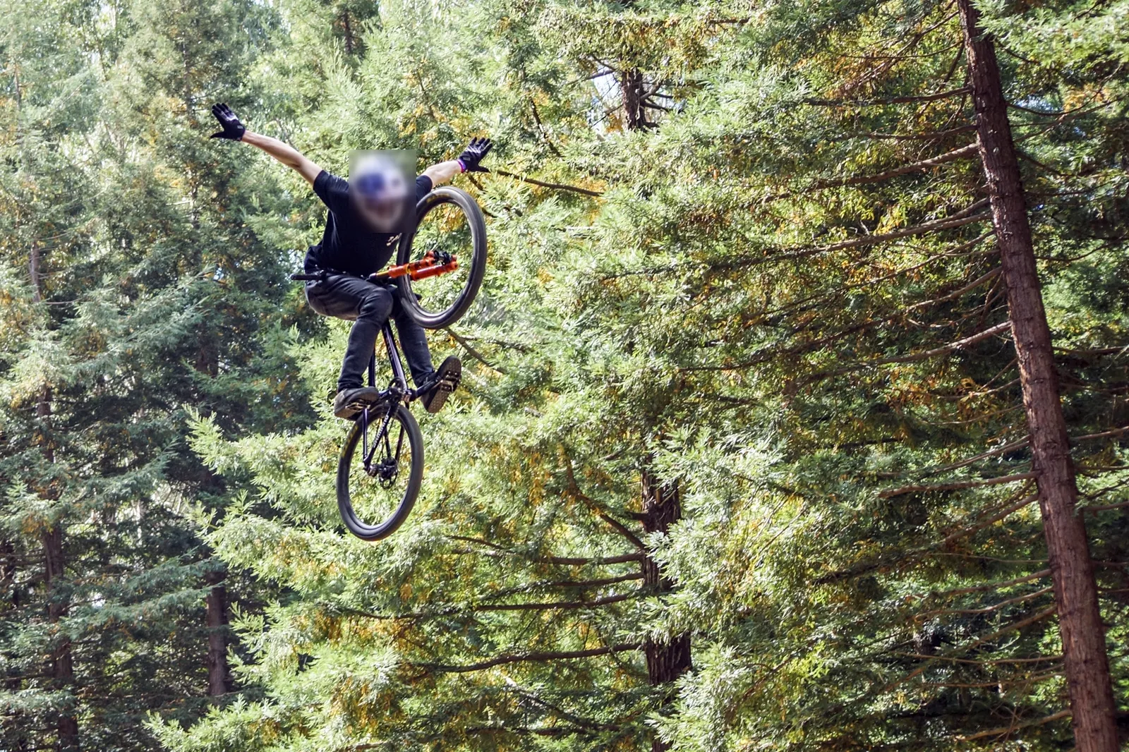
- 2018년 크랭크웍스 로토루아 대회에서 숲 속 점프…: XPinger (Chris Sutton), CC BY-SA 2.0 (원본에서 헬멧 부분 흐림 수정), CC BY-SA 2.0, 원본 — 크기 조정·WebP 변환
- 숲에 둘러싸인 티키타푸 호수(블루 레이크) 전경,…: Michal Klajban, CC BY-SA 4.0, 원본 — 크기 조정·WebP 변환
Read in English
Mountain Biking in Rotorua: A Beginner's Guide to the Redwoods Trails
Five to ten minutes' drive from central Rotorua, giant Californian redwoods close over your head. Beneath them, a web of mountain bike trails packed into volcanic soil runs through the forest, from flat family paths to jump lines that host international events. This guide is for visitors trying mountain biking for the first time in Whakarewarewa Forest, better known as The Redwoods. It explains who looks after the forest, how to read trail grades, which trails suit beginners, the Whakarewarewa Forest Loop Great Ride, where to start and hire a bike, and the safety rules. Information was checked on 30 September 2026 with Rotorua Lakes Council, Rotorua's tourism site (rotoruanz.com), the official Redwoods site and the New Zealand Cycle Trail site (nzcycletrail.com).
At a glance
- Location: about 5 minutes' drive from central Rotorua to the main entrance, about 10 minutes to the trailheads
- Trail network: official sources quote anything from 150 km to more than 300 km, and new trails keep appearing
- Entry: the forest, tracks and visitor centre are all free
- Opening hours: the forest is open 7am to 11pm every day except Christmas Day. Daylight use is recommended for safety (council Redwoods page)
- Signature ride: Whakarewarewa Forest Loop, about 33 km, 3 to 5 hours, mostly grade 2 (easy)
- Season: year-round. The free-draining volcanic soil means trails are rideable soon after rain
- Booking: trails need no booking. Book bike hire, shuttles and peak-season (December to March) accommodation ahead
- Check before you ride: Rotorua Trails Trust trail closures
Who runs The Redwoods?
No single body runs the whole forest, so it helps to know where notices come from. Rotorua Lakes Council's forest project page explains that "The Redwoods" is the popular name for two blocks: Tokorangi Forest, where the redwoods stand, and Whakarewarewa Forest, the commercial plantation beyond it.
- Landowner: Central North Island Iwi Holdings owns the land following its 2008 settlement with the Crown
- Recreation management: the council manages Tokorangi Forest and manages recreation in Whakarewarewa Forest under an agreement with the forest manager Timberlands and others
- Trail building: the mountain bike trails are built and maintained by the charity Rotorua Trails Trust. Riding is free, but the trails rely on donations, so consider giving if you enjoyed your ride
- Mana whenua: the land is significant to Tūhourangi Ngāti Wāhiao and Ngāti Whakaue. The council says full management and ownership will return to mana whenua iwi when the forestry licences end in 2043
This is still a working plantation forest. Logging or planting can close trails or create detours at short notice, so check the Trails Trust closure notices and follow signs on the ground.
How to read trail grades
The official Redwoods bike page uses six grades, shown on map boards at entrances and junctions. Maps are also on the Redwoods guide maps page.
- Beginner: fairly flat, wide, smooth track or gravel road
- Easy: mostly flat with gentle climbs, and rocks or potholes that are easy to avoid
- Intermediate: steep slopes and obstacles possible on narrow track, with poor traction in places
- Advanced: long steep climbs, narrow track and obstacles. Some parts may be easier to walk
- Expert: technical sections, giant climbs, drop-offs, sharp corners and some bike carrying
- Extreme: very steep sections, large drop-offs, man-made structures and jumps. Not a place for beginners
On the national cycle trail scale (grades 1 to 5), the Forest Loop is mostly grade 2 with a few short grade 3 sections. If you are new to mountain biking, start on Beginner and Easy trails and wait until you are comfortable with braking and shifting your weight before trying intermediate trails.
Whakarewarewa Forest Loop: a Great Ride for beginners
The Whakarewarewa Forest Loop circles the forest and joined New Zealand's Great Rides in May 2022. The tourism agency's Forest Loop page and the council describe it as 33 km, while the Ngā Haerenga official page and the Redwoods Forest Loop page list 35 to 36 km. It is mostly one-way, clockwise.
- Time: 3 to 5 hours. Experienced riders can do it in about 2 hours, and e-mountain bikes may be a little quicker
- Surface: wide, fine gravel and volcanic pumice. A mountain bike or e-mountain bike is best
- Highlights: redwood groves, views of Lake Rotorua and Lake Tikitapu (Blue Lake), steaming geothermal ground and bubbling mud, and Tūhourangi carvings at the trail hub
- Facilities: three places to buy food, four water refill points and three accessible toilets. Food outlets may close in winter or midweek, so carry snacks
- Charging: there are no e-bike charging stations on the trail, so start fully charged
- Caution: cutting back through the middle is not a shortcut. It crosses a large hilly plantation block
- Cultural respect: Lake Rotokākahi (Green Lake) is private for cultural reasons. Follow the signs and do not go down to its shore
Ngā Haerenga splits the loop into three sections, and you can ride just one if the full loop is too much.
- Te Pūtake o Tawa to Te Ara Ahi: 14 km, grade 2 to 3 (easy to intermediate), 1 to 2.5 hours
- Te Ara Ahi: 8.5 km, grade 2 (easy), 30 minutes, on a flat concrete path heading back towards town
- Waipa car park to Te Pūtake o Tawa: 10.5 km, grade 2 (easy), 1 to 2 hours
The same page also suggests short rides for beginners and families.
- Waipa–Dipper Loop: 5 to 6.5 km, 2 to 3 hours, grade 2, a beginner and kids' loop from the Waipa car park
- Titokorangi Loop: 8.5 km, 2 to 3 hours, grade 2 to 3, starting from the Redwoods Visitor Centre on Titokorangi Drive
- Tikitapu Loop: 14.5 km (8.5 km short option), 1.5 to 2 hours, grade 2, starting at Lake Tikitapu, which has a swimming lake, barbecue areas and a food store
Trail hubs and bike hire
- Waipa car park (Waipa State Mill Road): the main entry for mountain bikers, with direct access to the easiest trails, the Kids' Loop and the Forest Loop. There is bike hire, a café, showers, a bike wash and hot tubs
- Te Pūtake o Tawa (Tarawera Road): the second hub, opened in 2020, with parking for more than 400 vehicles. It gives direct access to the higher trails and the Tikitapu section, plus food, bike hire, wash-down and shower facilities
- Redwoods Visitor Centre (Titokorangi Drive): the start of the walking tracks, the place to pick up maps and information, and the start of the Titokorangi Loop above
- Shuttles: shuttles run to high points in the forest if you want to focus on descents (tourism agency mountain biking page)
- Hire and shuttles: hire and shuttle operators are listed on the Redwoods bike hire and shuttles page
- Guides and lessons: first-timers can book a guided ride or a skills session. Operators approved to work in the forest are on the Redwoods approved concessionaires list
The public cannot drive into the forest, so park at one of these three hubs. From town you can also ride there on Te Ara Ahi, a flat cycle path.
Sample plans
- Half day (families riding for the first time): hire bikes at the Waipa car park and ride Beginner and Easy trails such as the Waipa–Dipper Loop, then relax in the hot tubs
- Full day (riders with some experience): start the Forest Loop early at Te Pūtake o Tawa, stop at Waipa for lunch and finish the rest of the loop. The official guide notes that an early start puts you at Waipa around lunchtime
- Two days (intermediate riders): ride the Forest Loop on day one to learn the forest, then take a shuttle up on day two for intermediate descents. The tourism agency highlights Eagle vs Shark on the Te Pūtake o Tawa side
- Pair it with: Rotorua is a geothermal spa town, so a hot pool after riding rounds off the day well
Safety and forest rules
- Helmets: helmets are compulsory by law in New Zealand (NZTA cycling equipment rules), and the Redwoods code also asks for an approved helmet and protective clothing
- Direction and trails: ride in the direction of the arrows and don't cut corners or create new lines. There are separate walking, biking and horse trails, so keep to yours (Redwoods visitor information)
- Giving way: forestry roads are shared with forestry vehicles. Give way to walkers, uphill riders and horses, and slow down and call out when passing
- Gear: carry a map, water, snacks, a waterproof layer, a spare tube and tools, and first aid. The official guide recommends a personal locator beacon (PLB) and a first aid kit
- Phones: coverage is good along most of the loop but can be patchy around Tikitapu. Tell a trusted contact your planned start and finish times. For longer rides, fill in the NZ Mountain Safety Council's Outdoor Intentions Form for them, or send the full plan by text or email
- Emergencies: the forest's First Response Unit is on 0800 WHAKA 1 (0800 942 521). In a serious emergency also call 111
- Weather: the canopy shelters you from sun and wind, but check the MetService forecast before you go. After strong winds there may be fallen trees, so check the Trails Trust notices again
Useful phrases
- Which trails are good for beginners?
- Can I hire a bike and helmet for half a day?
- Is the Forest Loop open today?
- On your left / Rider up
Related reading
- How to choose from New Zealand's 23 Great Rides
- NZ cycling rules: helmets, road riding and bikes on trains
- NZ hot springs: Rotorua, Hanmer and Tekapo
- Riding the Queenstown Trail: between lakes and wineries
Photo credits
- XPinger (Chris Sutton), CC BY-SA 2.0 (원본에서 헬멧 부분 흐림 수정), CC BY-SA 2.0, source — resized and converted to WebP
- Michal Klajban, CC BY-SA 4.0, source — resized and converted to WebP
출처
- Rotorua Lakes Council — Enriching the Forest Experience (소유·관리 구조, 2043년 반환, Te Pūtake o Tawa, Forest Loop 33km·2022년 편입)
- Rotorua Lakes Council — The Redwoods: Tītokorangi & Whakarewarewa Forest (무료 입장, 개방 시간, 시내에서 5분)
- RotoruaNZ — Whakarewarewa Forest mountain biking (트레일 관리 Rotorua Trails Trust, Waipa, Te Pūtake o Tawa, 셔틀)
- RotoruaNZ — Whakarewarewa Forest Loop (33km, 3~5시간, 시설, 응급 0800 WHAKA 1)
- The Redwoods — Bike (트레일 등급 6단계, 안전 수칙)
- The Redwoods — Information (이용 수칙, 주차장 입구, 차량 출입 불가)
- The Redwoods — Whakarewarewa Forest Loop Great Ride (35km 표기, 가운데 지름길 아님)
- Ngā Haerenga — Whakarewarewa Forest Loop Great Ride (구간 Te Pūtake o Tawa—Te Ara Ahi 14km·Te Ara Ahi 8.5km·Waipa—Te Pūtake o Tawa 10.5km, 입문 코스 Waipa–Dipper·Titokorangi·Tikitapu Loop, 휴대전화 'good along most of the trail but can get patchy around Tikitapu', Green Lake 예절, PLB)
- Rotorua Trails Trust — 트레일 관리·기부·공지
- NZ Transport Agency — Cycling code: equipment (헬멧 의무)
- MetService — 날씨 예보
- Rotorua Trails Trust — Trail closures (현재 폐쇄 트레일 공지)
- The Redwoods — Approved Concessionaires (숲 안 영업 승인 업체 목록: 가이드·강습)
- The Redwoods — Bike Hire & Shuttles (대여·셔틀 업체)
- The Redwoods — Recreation Maps (트레일 지도)
- Leaving trip intentions — NZ Mountain Safety Council (믿을 만한 연락인에게 알리기, Outdoor Intentions 양식, 문자·이메일로 공유)