뉴질랜드 > 북섬 여행
통가리로 알파인 크로싱: 준비물·셔틀·날씨
통가리로 알파인 크로싱(Tongariro Alpine Crossing)은 하루 만에 활화산 두 봉우리 사이를 가로지르는 뉴질랜드 북섬의 대표 당일 산행입니다. 붉게 탄 듯한 레드 크레이터 가장자리에서 내려다보면 에메랄드빛 호수들이 김이 피어오르는 화산 지형 사이에 박혀 있습니다. 이 글에서는 거리·시간·고도 같은 기본 정보, 무료 예약과 셔틀 이용법, 날씨 권고 기준, 계절별 준비물과 안전 수칙을 정리합니다. 정보는 2026년 9월 30일에 DOC(자연보존부)와 뉴질랜드 관광청 공식 페이지에서 확인했습니다.
한눈에 보기
- 거리: 편도 20.2 km (출발점과 도착점이 다른 횡단 코스)
- 소요 시간: 11~4월 7~8시간, 5~10월 9시간
- 고도: 출발 1,120 m → 최고점 레드 크레이터 1,886 m → 도착 760 m
- 난이도: 체력 '높음'. 여름엔 중급 트랙, 5~10월엔 전문가 루트
- 추천 계절: 11월~4월. 10월 말 노동절 주말 전까지는 겨울 조건입니다
- 비용: 트랙 예약은 무료, 셔틀은 따로 요금이 있습니다
- 예약: 모든 이용자에게 권장, 셔틀·가이드를 이용하려면 필수
- 주의: 10세 미만 어린이 비권장, 개·산악자전거 금지, 허가 없는 드론 금지
어떤 길인가요
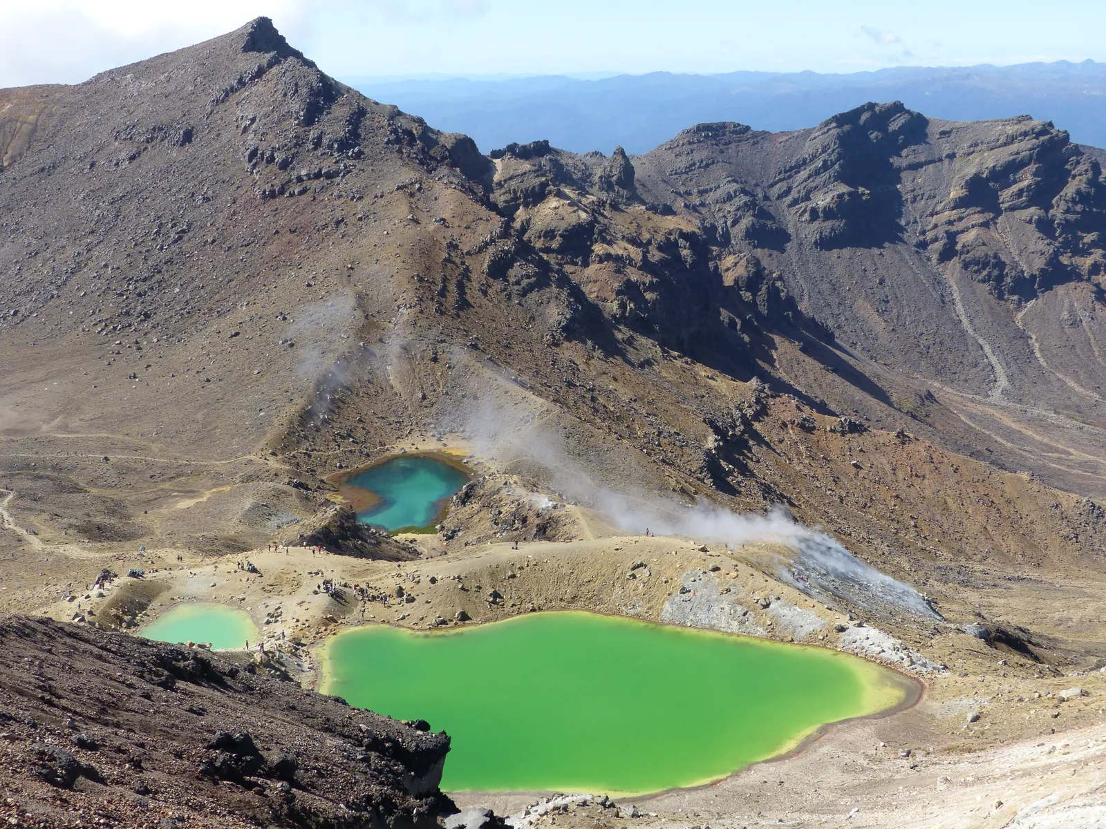
DOC 트랙 안내에 따르면 길은 이렇게 이어집니다.
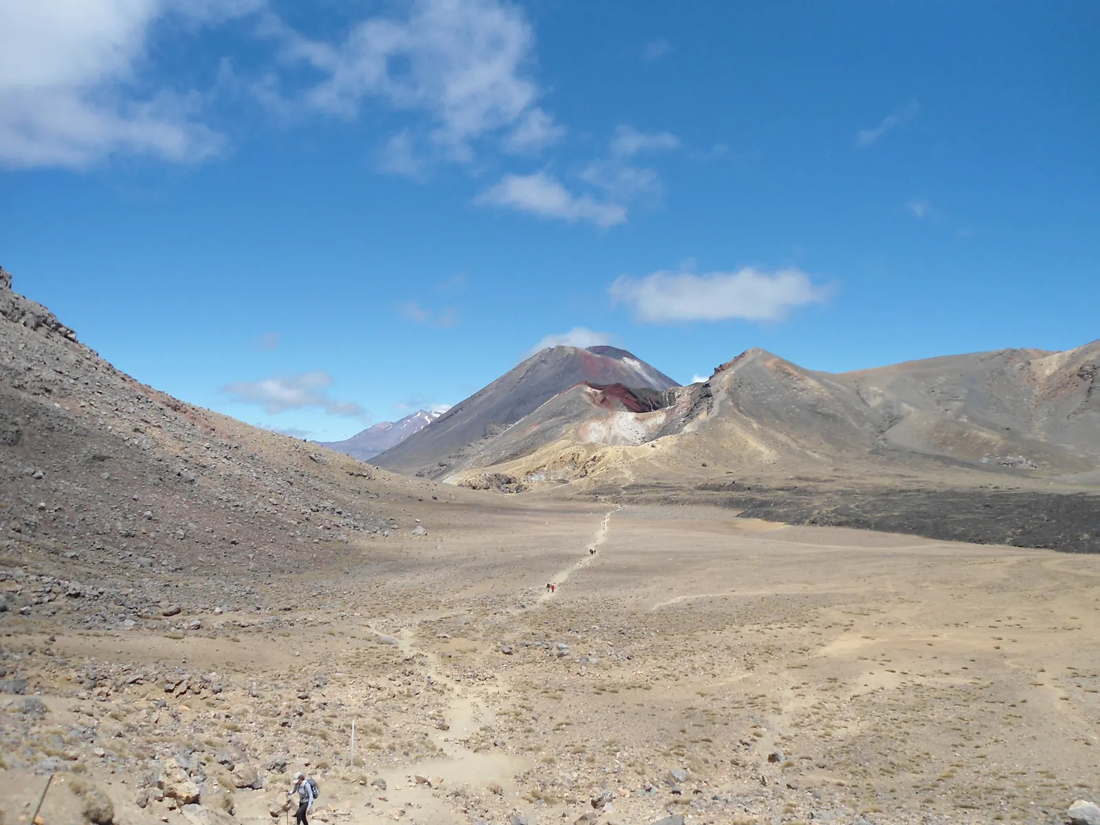
- 망가테포포 계곡(1,120 m): 잘 닦인 나무 데크로 완만하게 오릅니다. 처음 5.4 km는 소다 스프링스 워크와 같은 길입니다.
- 사우스 크레이터: 계곡 끝에서 약 350 m를 계단으로 올라 평평한 분화구 바닥에 닿습니다.
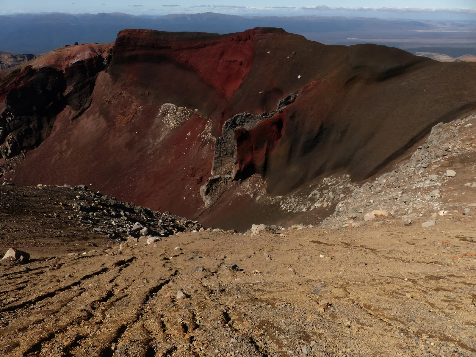
- 레드 크레이터(1,886 m): 코스에서 가장 높은 곳입니다. 붉은 분화구 벽과 지층이 드러나 있습니다.
- 에메랄드 호수(Ngā Rotopounamu): 화산 자갈이 깔린 가파른 내리막 끝에 있습니다. 이 내리막은 돌이 잘 굴러 미끄러지기 쉬우니 시간을 넉넉히 잡으세요.
- 블루 레이크: 에메랄드 호수를 지나 만나는 호수로, 마오리어 이름은 '랑이히로아의 거울'이라는 뜻입니다.
- 북쪽 사면과 케테타히(760 m): 지그재그 계단 내리막이 길게 이어지고, 로토아이라 호수와 타우포 호수가 내려다보입니다. 마지막엔 숲을 지나 케테타히 로드에서 끝납니다.
오르내리는 고도는 모두 합쳐 약 1,196 m입니다. 관광청은 반대 방향(케테타히 출발)도 가능하지만 1시간쯤 더 걸린다고 안내합니다.
무료 예약하는 법
DOC는 2023년 10월부터 무료 예약제를 운영합니다. 예약 안내의 핵심은 다음과 같습니다.
- 누가: 트랙 전부나 일부를 쓰는 모든 사람에게 권장합니다. 셔틀이나 가이드를 쓰려면 예약이 있어야 합니다.
- 비용: 없습니다. 예약 없이 와도 벌칙은 없고, 인원 상한도 없습니다.
- 방법: 온라인 양식을 한 그룹에 한 번 작성합니다. 대표자 이름, 전화번호, 이메일이 필요합니다. 방문자센터나 i-SITE에서 대신 예약해 줄 수도 있습니다.
- 확인: 예약 영수증 이메일을 저장해 두세요. 주차장에서 레인저에게 휴대전화 화면이나 종이로 보여 줘야 합니다.
- 변경: 날짜가 바뀌면 양식을 다시 작성하면 되고, 기존 예약을 취소할 필요는 없습니다.
- 예외: 통가리로 노던 서킷 산장이나 캠프장을 예약한 사람은 따로 예약하지 않아도 됩니다.
가는 법: 셔틀이 가장 편합니다
크로싱은 출발점과 도착점이 산 반대편에 있어서 차 한 대로 왕복하기 어렵습니다. 노동절 주말(10월 말)부터 4월 30일까지는 도로 끝 주차장에 4시간 주차 제한이 있고, DOC는 여름에 망가테포포 주차장에 크로싱 방문객이 주차할 수 없다고 안내합니다. 국도변에 차를 세우는 것도 권하지 않습니다.
- 셔틀: 오하쿠네, 타우마루누이, 투랑이, 타우포 같은 주변 마을 안내소에서 예약할 수 있습니다. DOC 페이지에는 약 $40인 셔틀 요금 일부가 보전 사업에 쓰인다고 나와 있는데, 요금은 업체와 출발지마다 다르니 예약할 때 확인하세요.
- 가까운 마을: 와카파파 빌리지 10.4 km, 내셔널 파크 13.5 km, 투랑이 36.7 km, 오하쿠네 48 km, 타우포 86.5 km
- 비행기: 가장 가까운 공항은 타우포이고, 와카파파 빌리지까지 차로 약 1시간 20분입니다.
- 도착 쪽 주차: 케테타히 근처에 사설 주차장이 있습니다.
날씨: 'Not Recommended Today' 권고 읽는 법
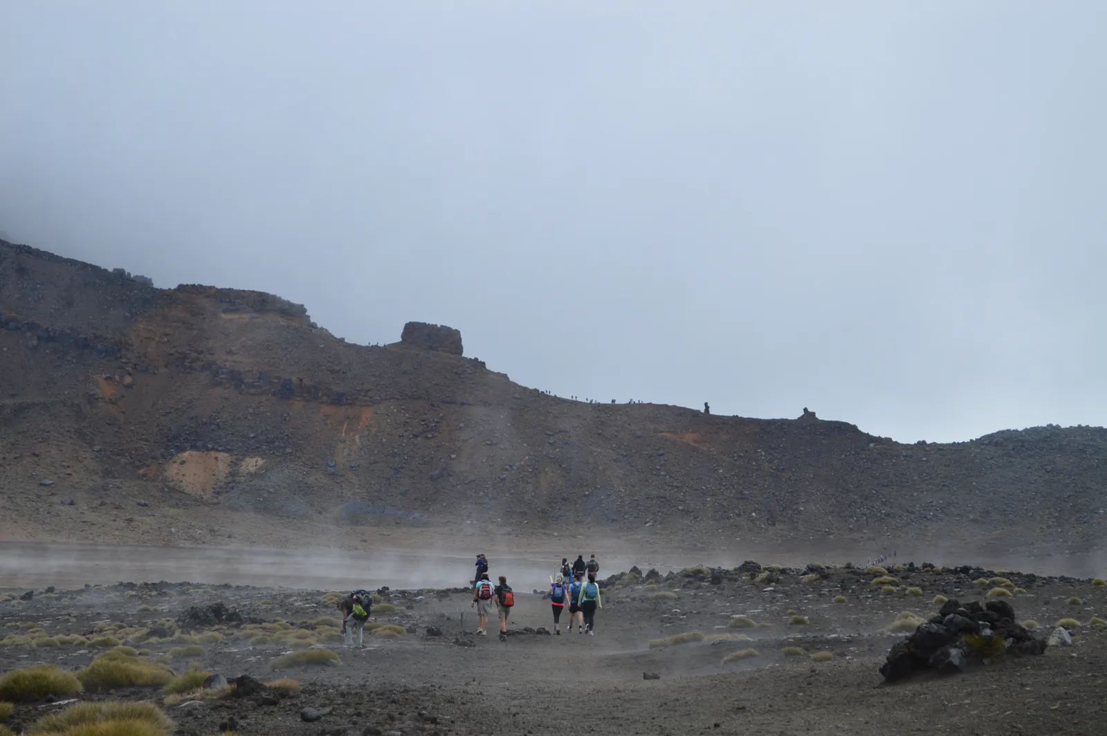
이 트랙은 고산 지대라 여름에도 강풍, 추위, 폭우, 짙은 안개가 흔하고 눈은 1년 내내 올 수 있습니다. 여름 시즌(11~4월)에 DOC는 매일 오전 6시에 NIWA의 레드 크레이터 예보를 보고, 오전 9시~오후 5시 사이 두 시간 이상 아래 조건 중 하나를 넘으면 '오늘은 권하지 않음(Not Recommended Today)' 권고를 냅니다.
- 평균 풍속 시속 55 km 이상, 또는 돌풍 시속 70 km 이상
- 체감 온도 영하 10°C 이하, 또는 체감 0°C 이하이면서 강수 1 mm 이상
- 비 시간당 2.5 mm 이상, 또는 눈 시간당 0.1 cm 이상
- 또는 오전 9시~오후 5시 중 6시간 누적 강수 10 mm 이상
권고가 나오면 망가테포포 입구에 안내판이 서고, NIWA 통가리로 국립공원 예보에도 알림이 붙습니다. 셔틀·가이드 업체와 안내소에도 이메일로 전달됩니다. 5~10월에는 이 권고가 나오지 않으니 예보를 직접 읽고 스스로 판단해야 합니다. 날씨가 나쁘면 DOC가 대안으로 소개하는 타라나키 폭포나 타마 호수 트랙을 고려해 보세요.
여름(11~4월) 준비물
DOC는 당일 산행 준비물 목록에 더해 물 2~3 L를 챙기라고 안내합니다. 트랙의 물은 마실 수 없습니다.
- 물 2~3 L, 점심과 넉넉한 간식
- 방수 재킷과 방수 바지, 모자, 장갑, 여러 겹의 보온 옷(면 대신 울이나 합성 소재)
- 발목을 잡아 주는 튼튼한 등산화
- 자외선 차단제와 선글라스(관광청은 여름·겨울 모두 챙기라고 안내)
- 휴대전화, 헤드랜턴, 구급약, 휴지
- 화장실은 1~2시간마다 있지만, 출발점 화장실 줄이 길면 1 km(약 20분) 뒤에 다음 화장실이 있습니다
겨울(5~10월)은 전문가 루트입니다
5월부터 10월 말까지는 눈과 얼음, 눈사태 위험, 영하의 기온 때문에 전문가 루트로 바뀝니다. DOC는 이 기간에 가이드와 함께 가라고 권합니다. 레드 크레이터는 바람이 없어도 타우포보다 10°C 이상 춥고, 바람이 시속 10 km 늘 때마다 2°C씩 더 춥게 느껴집니다.
- 필수 장비: 아이젠, 피켈, 헬멧과 쓰는 기술
- 눈사태 장비: 비콘(트랜시버), 프로브, 삽
- 개인 조난 신호기(PLB), 헤드랜턴과 예비 배터리, 지도·나침반 또는 GPS
- 겨울엔 셔틀이 대부분 운행하지 않지만 가이드 투어에는 교통이 포함됩니다
오늘(9월 30일) 기준으로는 아직 겨울 조건 기간입니다. 여행 날짜가 10월이라면 가이드 투어를 알아보거나, 눈사태 예보와 방문자센터 안내를 꼭 확인하세요.
화산·지열·문화: 꼭 지킬 것
- 활화산 지역입니다. 가능성은 낮지만 분화는 언제든 일어날 수 있습니다. 출발 전 GeoNet 화산 경보 단계를 확인하세요.
- 에메랄드 호수 주변 증기 구멍에는 다가가지 마세요. 증기가 매우 뜨겁고 땅이 무를 수 있습니다.
- 호수를 만지거나 들어가지 마세요. 이 산과 물은 지역 이위(부족) 응아티 히카이로 키 통가리로에게 신성한 곳입니다.
- 2025년 말 화재 두 건으로 출발점 주변이 탔고, 10년 동안 회복을 위한 라후이(rāhui)가 선포되었습니다. 표시된 길 밖으로 나가지 말고, 오기 전에 신발과 장비를 깨끗이 하고, 쓰레기는 모두 가져가세요.
통가리로는 1894년 뉴질랜드 첫 국립공원이 되었고, 1993년에는 문화경관 기준으로 세계유산에 오른 첫 사례입니다.
하루 일정 예시
- 전날: 내셔널 파크, 투랑이, 오하쿠네, 타우포 중 한 곳에 묵고 셔틀과 트랙 예약을 마칩니다.
- 당일 아침: 셔틀로 망가테포포 출발점까지 이동, 주차장 레인저에게 예약 확인서를 보여 줍니다.
- 오전: 망가테포포 계곡과 계단을 올라 사우스 크레이터, 레드 크레이터까지 갑니다. 속도가 너무 느리거나 날씨가 나빠지면 돌아설 지점을 미리 정해 두세요.
- 점심 무렵: 에메랄드 호수와 블루 레이크 주변에서 쉽니다.
- 오후: 케테타히까지 긴 내리막을 내려와 약속한 시간에 셔틀을 탑니다.
- 자신이 없다면: 소다 스프링스 왕복(약 2시간)만 걸어도 화산 계곡의 분위기를 느낄 수 있습니다.
안전: 산행 계획을 남기세요
- 출발 전에 믿을 만한 사람에게 코스와 돌아올 시간을 알려 두세요. 산악안전위원회(MSC)의 Plan My Walk나 야외 산행 계획서를 쓸 수 있습니다.
- 조난 신호기(PLB)를 챙기면 위급할 때 구조를 요청할 수 있습니다. 통가리로 국립공원 방문자센터(와카파파 빌리지, +64 7 892 3729)에서 빌릴 수 있습니다.
- 서로 챙기고 함께 결정하세요. 늦어지면 망설이지 말고 돌아서는 것이 가장 좋은 선택일 때가 많습니다.
함께 읽으면 좋은 글
사진 출처
- 화산 봉우리 아래 김이 피어오르는 비탈 사이에 있는…: Du Hugin Skulblaka, CC BY-SA 4.0, 원본 — 크기 조정·WebP 변환
- 넓고 평평한 화산 분화구 바닥을 가로지르는 가느다란…: Blueromulan, CC BY-SA 3.0, 원본 — 크기 조정·WebP 변환
- 흐린 날 바람에 먼지가 날리는 분화구 바닥을 줄지어…: Porcinno Rondus, CC BY 3.0, 원본 — 크기 조정·WebP 변환
- 붉은색과 검은색 지층이 드러난 레드 크레이터 분화구…: Du Hugin Skulblaka, CC BY-SA 4.0, 원본 — 크기 조정·WebP 변환
Read in English
Tongariro Alpine Crossing: Gear, Shuttles and Weather
The Tongariro Alpine Crossing is the North Island's signature day hike, a one-day traverse through the heart of an active volcanic landscape. From the rim of Red Crater you look down on emerald-coloured lakes set among steaming volcanic ground. This guide covers the basics (distance, time and altitude), the free booking and shuttles, how the weather advisory works, what to pack in each season and the safety rules. Information was checked on the official DOC (Department of Conservation) and Tourism New Zealand pages on 30 September 2026.
At a glance
- Distance: 20.2 km one way (a traverse; start and finish are in different places)
- Time: 7 to 8 hours from November to April, 9 hours from May to October
- Altitude: start 1,120 m, high point Red Crater 1,886 m, finish 760 m
- Difficulty: high fitness required. An intermediate track in summer, an expert route from May to October
- Best season: November to April. Winter conditions apply until Labour Weekend in late October
- Cost: booking the track is free; shuttles are paid separately
- Booking: recommended for everyone, and required if you use a shuttle or guide
- Note: not recommended for children under 10; no dogs, no mountain bikes, no drones without a permit
The route
According to DOC's track page, the track runs like this.
- Mangatepōpō Valley (1,120 m): a gradual climb on a well-formed boardwalk. The first 5.4 km is shared with the Soda Springs Walk.
- South Crater: at the end of the valley, a climb of about 350 m up a staircase brings you to a flat crater floor.
- Red Crater (1,886 m): the highest point, with red crater walls and exposed rock layers.
- Emerald Lakes (Ngā Rotopounamu): at the bottom of a steep descent on loose volcanic scree. Rocks roll easily here, so take extra time and care.
- Blue Lake: past the Emerald Lakes; its Māori name means "Rangihīroa's mirror".
- Northern slopes and Ketetahi (760 m): a long zig-zag descent with many steps and views over Lake Rotoaira and Lake Taupō, ending through forest at Ketetahi Road.
Total elevation change is about 1,196 m up and down. Tourism New Zealand says you can walk it in reverse (from Ketetahi), but allow about an extra hour.
How to book (free)
DOC introduced a free booking system in October 2023. The key points from the booking page:
- Who: recommended for anyone using all or part of the track. You need a booking to use a shuttle or guided walk.
- Cost: none. There is no penalty for turning up without one, and no cap on numbers.
- How: fill in one online form per group, with the group leader's name, phone and email. Visitor centres and i-SITEs can book for you.
- Confirmation: save the receipt email. Your group shows it, on a phone or on paper, to rangers at the car park.
- Changes: just complete the form again for a new date; you do not need to cancel.
- Exception: people with a Tongariro Northern Circuit hut or campsite booking do not need to book.
Getting there: shuttles are easiest
The start and finish are on opposite sides of the mountain, so a single car does not work well. From Labour Weekend (late October) to 30 April there is a 4-hour parking limit at the road ends, and DOC says there is no parking for Crossing walkers at Mangatepōpō in summer. Parking on the state highway verge is not recommended.
- Shuttles: book through visitor centres in nearby towns such as Ohakune, Taumarunui, Tūrangi and Taupō. DOC's page says part of the shuttle fee of about $40 supports conservation, but prices vary by operator and pick-up town, so confirm when you book.
- Nearby towns: Whakapapa Village 10.4 km, National Park 13.5 km, Tūrangi 36.7 km, Ohakune 48 km, Taupō 86.5 km
- Flying: the nearest airport is Taupō, about 1 hour 20 minutes' drive from Whakapapa Village.
- Parking at the finish: there is a private car park near Ketetahi.
Weather: reading the "Not Recommended Today" advisory
This is alpine terrain. Strong wind, cold, heavy rain and poor visibility are common even in summer, and snow can fall in any month. In the summer season (November to April), DOC checks NIWA's Red Crater forecast at 6 am every day and applies a "Not Recommended Today" advisory if, on any two hours between 9 am and 5 pm, the forecast exceeds any of these:
- average wind 55 km/h or more, or gusts of 70 km/h or more
- wind chill of minus 10°C or colder, or 0°C or colder with 1 mm or more of precipitation
- rain of 2.5 mm/h or more, or snow of 0.1 cm/h or more
- or 10 mm or more of precipitation accumulated over six hours between 9 am and 5 pm
When it applies, a sign goes up at the Mangatepōpō road end, an alert appears on the NIWA Tongariro National Park forecast, and shuttle and guiding operators and visitor centres are emailed. No advisories are issued from May to October, so you have to read the forecast and decide for yourself. In poor weather, DOC suggests alternatives such as the Taranaki Falls or Tama Lakes tracks.
Summer gear (November to April)
On top of DOC's day-hike gear list, take 2 to 3 litres of water. Water along the track is not safe to drink.
- 2 to 3 litres of water, lunch and plenty of snacks
- waterproof jacket and overtrousers, hat, gloves and warm layers (wool or synthetic, not cotton)
- sturdy boots with ankle support
- sunscreen and sunglasses (Tourism New Zealand says to bring them summer or winter)
- phone, head torch, first aid kit, toilet paper
- toilets are every 1 to 2 hours; if there is a queue at the start, the next toilets are only 1 km (about 20 minutes) away
Winter (May to October) is an expert route
From May to late October, snow, ice, avalanche risk and sub-zero temperatures turn the Crossing into an expert route, and DOC recommends going with a guide. Even on a calm day, Red Crater is at least 10°C colder than Taupō, and every extra 10 km/h of wind makes it feel about 2°C colder.
- essential: crampons, ice axe and helmet, and the skills to use them
- avalanche gear: transceiver, probe and shovel
- personal locator beacon (PLB), head torch and spare batteries, map and compass or GPS
- shuttles generally do not run in winter, but guided trips include transport
As of today (30 September), winter conditions still apply. If you are going in October, look at guided trips and check the avalanche forecast and the visitor centre's advice.
Volcano, geothermal areas and culture: the rules
- This is an active volcanic area. Eruptions are unlikely but can happen at any time. Check the GeoNet volcanic alert level before you go.
- Keep away from steam vents around the Emerald Lakes. The steam is very hot and the ground can be unstable.
- Do not touch or enter the lakes. The mountains and waters are sacred to the local iwi, Ngāti Hikairo ki Tongariro.
- Two fires in late 2025 burned the area around the start, and a 10-year restorative rāhui is in place. Stay on the marked track, clean your shoes and gear before you come, and take all rubbish home.
Tongariro became New Zealand's first national park in 1894, and in 1993 it was the first site inscribed on the World Heritage List under the cultural landscape criteria.
A sample day
- The day before: stay in National Park, Tūrangi, Ohakune or Taupō, and finish your shuttle and track bookings.
- Morning: take the shuttle to the Mangatepōpō start and show your booking to rangers at the car park.
- Late morning: climb the valley and staircase to South Crater and Red Crater. Agree on a turnaround point in case you are too slow or the weather turns.
- Around lunch: rest near the Emerald Lakes and Blue Lake.
- Afternoon: descend the long northern slopes to Ketetahi and meet your shuttle on time.
- Not sure you are up to it: the Soda Springs return walk (about 2 hours) still gives you the feel of the volcanic valley.
Safety: leave your trip plan
- Tell someone you trust your route and return time before you go. The Mountain Safety Council's Plan My Walk or the outdoor intentions form both work.
- A personal locator beacon (PLB) lets you call for help in an emergency. You can hire one at the Tongariro National Park Visitor Centre (Whakapapa Village, +64 7 892 3729).
- Look after each other and decide together. If you are running late, turning back is often the best choice.
Related reading
- New Zealand's Great Walks at a glance
- Hiking safety in New Zealand: the Land Safety Code and trip intentions
- Camping weather and gear in New Zealand
- How to use DOC campsites
Photo credits
- Du Hugin Skulblaka, CC BY-SA 4.0, source — resized and converted to WebP
- Blueromulan, CC BY-SA 3.0, source — resized and converted to WebP
- Porcinno Rondus, CC BY 3.0, source — resized and converted to WebP
- Du Hugin Skulblaka, CC BY-SA 4.0, source — resized and converted to WebP
출처
- Tongariro Alpine Crossing — DOC (거리·시간·고도, 주차·셔틀, 권고 기준, 겨울 조건, 준비물, 화재·라후이, 문화)
- Tongariro Alpine Crossing booking system — DOC (무료, 권장, 셔틀·가이드 필수, 영수증 제시, 노던 서킷 예약자 면제)
- Sustainable visitor management for Tongariro — DOC (2023년 10월 무료 예약제, 인원 상한 없음)
- Tongariro Alpine Crossing — Tourism New Zealand (역방향 +1시간, 타우포 공항 1시간 20분, 성수기 12~2월, 자외선)
- Tongariro National Park forecast — NIWA
- NZ Avalanche Advisory — Tongariro
- Volcanic alert levels — GeoNet
- Distress beacons (PLB 대여 가능 DOC 방문자센터 목록) — DOC
- Leaving trip intentions — NZ Mountain Safety Council